Tech4Nature Awards: Meet the Finalists
International Union for Conservation of Nature and Huawei launched the Tech4Nature global partnership in 2020 to scale up success in nature conservation through technological innovation. Aligned with Huawei’s TECH4ALL initiative and the IUCN Green List, Tech4Nature has supported 11 flagship projects in 8 countries with tailored solutions to conservation challenges.
Learn more about those projects here.
In 2024, we jointly launched the Tech4Nature Awards to celebrate innovations from across the nature conservation community and promote tech-driven conservation solutions on a global scale. At the upcoming IUCN World Conservation Congress, we will be announcing the winners from the award's three categories:
1. Tech Innovation
2. NatureTech Stewards
3. Species Conservation
Below are the finalists and a summary of the solutions they've submitted for consideration by an expert panel. One solution from each category will receive an award. Check out the solutions and drop a comment about which ones spark your interest!
More background info about the awards can be found in this blog post: The Tech4Nature Award: What It Is & How You Can Apply
Category 1: Tech Innovation
- The Tech Innovation for Area-based Conservation category spotlights how digital innovation drives the 30x30 vision for people and nature.
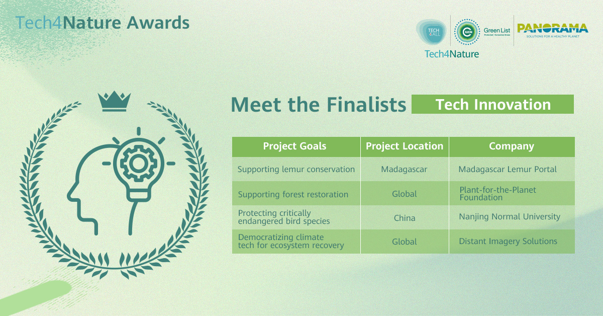
1. Supporting Lemur Conservation, Madagascar Lemur Portal
Project name: Madagascar Lemur Portal: Bridging technology and biodiversity conservation
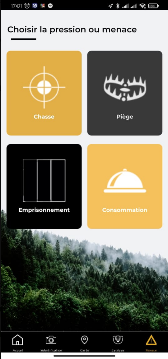
Threat profiles on the app / Image credit: MLP
Madagascar Lemur Portal (MLP) serves as a digital hub for empowering conservation efforts in Madagascar, including the critically endangered lemur. Combining a website and mobile application, the MLP project provides tools for ecological monitoring, data sharing, and community engagement. The platform offers a lemur species database, geospatial mapping of occurrence points, and offline data collection capabilities.
- Limited human and financial resources at the protected-area level for ecological monitoring of conservation targets.
- Fragmented field data and weak collaboration between conservation stakeholder communities at all levels. Centralized information not conducive to adaptive results-based management at protected area level.
2. Supporting Forest Restoration, Plant-for-the-Planet Foundation
Project name: Forest Cloud - A Digital Hub for Global Restoration and Conservation
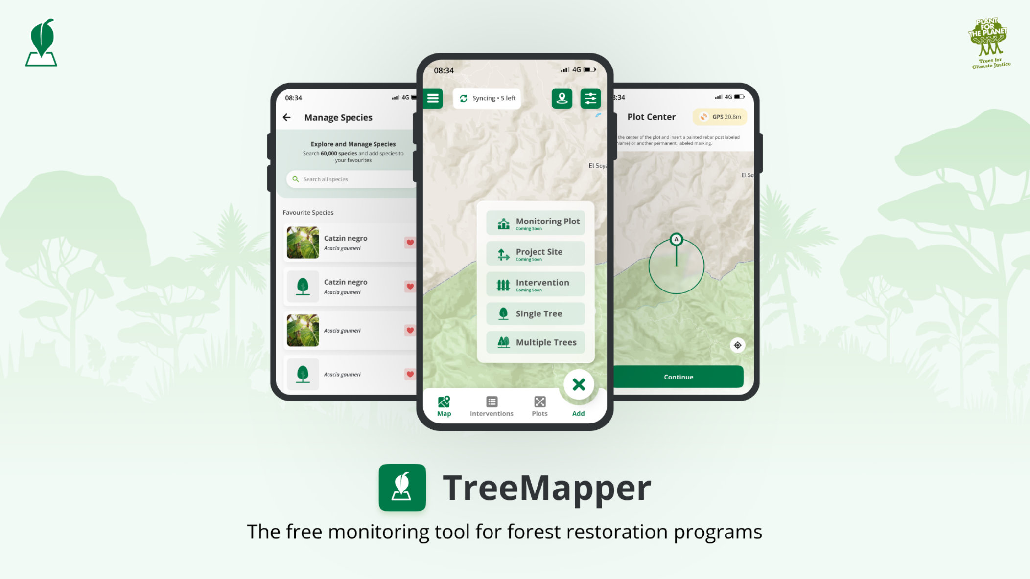
TreeMapper / Image Credit: Plant-for-the-Planet Foundation
Since 2018, it has evolved to bring back a trillion trees and conserve 3 trillion existing trees. The open-source, open access, digital solution currently supports scientific restoration initiatives as well as managing and coordinating conservation and restoration efforts globally. It benefits from robust Restoration Standards, proprietary restoration monitoring applications, a robust peer-review system and an ecosystem of ancillary digital solutions - the ‘Forest Cloud’.
Proven across 300 restoration initiatives and growing, the Platform unifies restoration organizations (ROs), donors, and scientists. Having demonstrated its success by restoring over 94M trees in 6 years, we now seek to improve its scale and geographic reach and solve the logistical challenges to contribute to a sustainable, thriving future.
3. Protecting Critically Engangered Bird Species, Nanjing Normal University
Project name: Leveraging Remote Sensing for Ecological Management at Jiangsu Yangcheng Wetland & Rare Birds National Natural Reserve
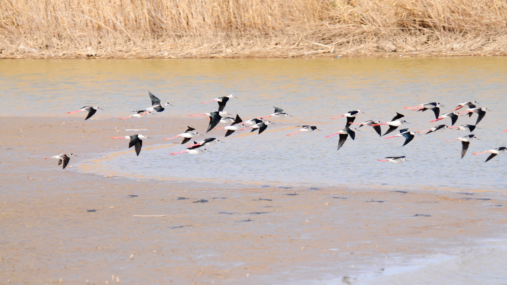
Grus japonensis at Jiangsu Yangcheng Wetland & Rare Birds National Natural Reserve / Image credit: Nanjing Normal University
Jiangsu Yancheng Wetland & Rare Birds National Natural Reserve is home to the critically endangered Grus japonensis and other rare species that are dependent on wetland mudflat ecosystems. However, invasive species like Spartina alterniflora threaten biodiversity, causing ecological degradation and diminishing biodiversity. To address this, remote sensing technology is used to monitor vegetation evolution, offering valuable insights for ecological management.
Yangtze River Delta Pilot Site of the UN Ocean Decade’s CoastPredict Program, led by Nanjing Normal University, combines remote sensing technology and conservation efforts to support management in Yancheng. Remote sensing has tracked the evolution of key wetland vegetation (Spartina alterniflora, Suaeda salsa, and Phragmites australis) since 1990, helping to understand environmental impacts, human activities, and species interactions. This initiative aids in developing more effective conservation strategies, benefiting both the reserve and broader global efforts.
Project name: Radical Restoration: Democratizing Climate Tech for Ecosystem Recovery
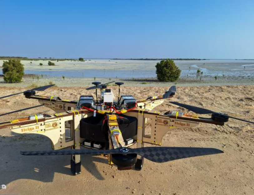
Self engineered mangrove planting drones / Image credit: Distant Imagery Solutions
In 2024, Distant Imagery Solutions planted 5.5 million mangroves in the UAE using self-engineered wooden drones designed for simplicity, adaptability, and cost-effectiveness. This milestone redefines the potential of community-driven, ecosystem-based restoration.
With projects ready in Brazil, Tonga, Kenya, and Indonesia, Distant Imagery empowers communities to lead. Our licensing and training platform equips locals to build and operate drones, fostering global knowledge exchange.
More than a technological solution, this is a movement of shared empowerment and stewardship. By connecting communities, Distant Imagery creates a global network innovating together to restore ecosystems and build climate resilience.
Also, our AI-powered Monitoring, Reporting, and Verification (MRV) system tracks restoration progress and combats illegal activities, ensuring ecological recovery and long-term protection.
Category 2: NatureTech Stewards
- The NatureTech Stewards category celebrates communities advancing digital solutions and technology to safeguard biodiversity and lead conservation on the ground.
Project name: Technology with Roots: Indigenous Guaraní Guardians, Safeguarding the Guanaco and Their Territories
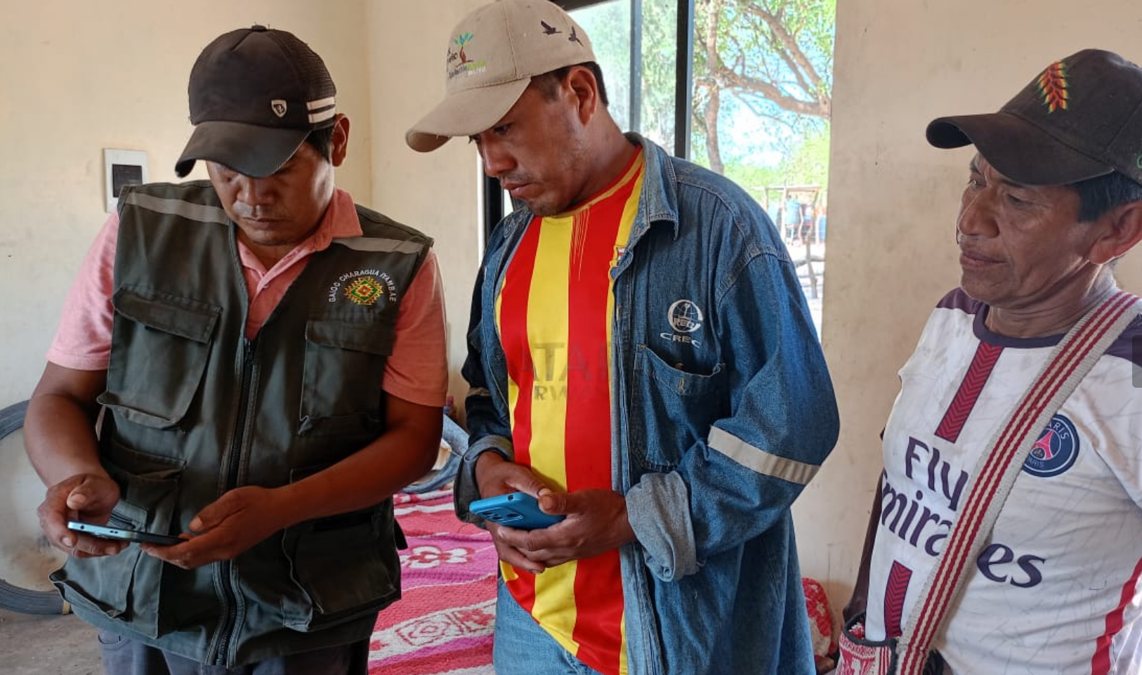
Community guardians show SMART data on their phones at Fundación Natura Bolivia / Image credit: Fundación Natura Bolivia
In the Guajukaka Life Area, a protected area of the Guaraní Charagua Iyambae Indigenous Autonomy, covering 284,670 hectares, 10 community Guaraní guardians lead an innovative solution to conserve the Chaco guanaco (Lama guanicoe), a key species for biodiversity.
The project combines traditional knowledge with advanced technology, such as camera traps and the SMART system, which allows monitoring without an Internet connection and collecting critical data on habitats and threats like poaching.
Additionally, DNA studies of the species are being promoted, with training led by the Natura Bolivia Foundation. The results strengthen community leadership, generate key data for sustainable management, and reaffirm Guaraní identity, inspiring replicable models in other protected areas.
2. Empowering Community Action for Resilient Grasslands, African People and Wildlife
Project name: Empowering Community Action for Resilient Grasslands
Maasai pastoralists attend training on mobile data collection / Image credit: Emily Tunuka/African People and Wildlife
African People & Wildlife’s Sustainable Rangelands Initiative keeps grasslands open and flourishing for the long-term benefit of rural communities and wildlife.
Taking a holistic, community-driven approach, our team trains and deploys community habitat monitors and collaborates with village leadership to restore vital habitat.
Through monthly data collection, habitat monitors use state-of-the-art mobile technology to provide updates on pasture quality to natural resource decision-makers in their communities. A suite of customized Esri geo-spatial applications and tools, including Survey123, ArcGIS Dashboards, and ArcGIS Hub, have been designed by the APW team to generate a long-term pasture quality dataset.
This invaluable dataset streams in real-time into culturally relevant visualization tools that inform conservation interventions. Results including increased grass height, increased vegetation cover, and the reduction of invasive and problematic plant species have been observed in these community-managed grazing areas.
3. Real-time Forest Monitoring, Rainforest Foundation, UK
Project name: ForestLink: Real-Time Forest Monitoring & Inclusive Decision-Making for Biodiversity
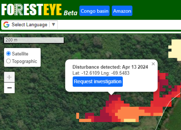
Deforestation intelligence with ForestEye / Image credit: RFK
Innovative & low-tech, our ForestLink tech empowers Indigenous people & local communities to monitor tropical forests where they live in real-time, reducing deforestation & protecting human rights & the environment.
Using just a mobile phone, forest communities can report illegal activities via satellite, even from remote areas, putting power back in their hands. ForestLink leverages their unique knowledge to defend their rights & influence extractive industries. Being a highly adaptable tool, ForestLink is currently deployed in 5 countries, where it covers a range of issues, e.g. GBV, land rights violations, and forest illegalities.
Data collection can be adapted for smartphones, or simply via SMS, ensuring access to the most remote communities. ForestLink is developed & used in accordance with a rights-based approach & in line with the principles of consent & do-no-harm. Any use of data is in accordance with survivor-centred principles.
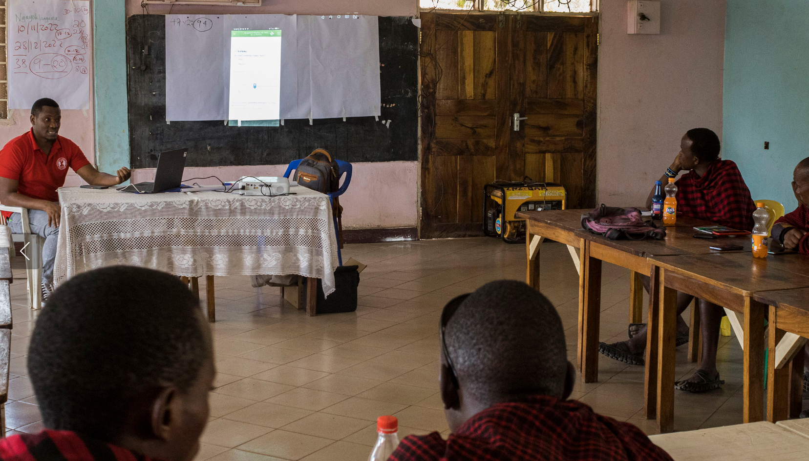
4. Empowering Women in Conservation, WILDLABS
Project name: Empowering Women in Conservation Technology: Shaping Africa's Conservation Future
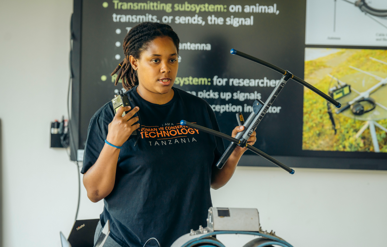
Participants learn wildlife tracking techniques / Image credit: Danny Samwell
Technology transforms how conservationists combat environmental threats.
While tech tools are becoming more accessible, the knowledge to use them remains unequally distributed. To address gender and geographic disparities, we developed a training program that equips women from the Global South with conservation technology skills.
The program combines classroom instruction with hands-on experience in tools used for biodiversity monitoring, protected area management, and human-wildlife coexistence. To ensure relevance and lasting impact, we partner with local female technology experts who serve as instructors and mentors. Further, we fund participants to launch tech-based conservation projects and provide ongoing professional development and alumni support. This program helps women build technical portfolios and pursue academic and conservation leadership roles.
Our vision is to create a global network of emerging female conservation leaders, promoting gender equity, regional capacity, and locally led biodiversity protection.
Project name: Arribaba Club
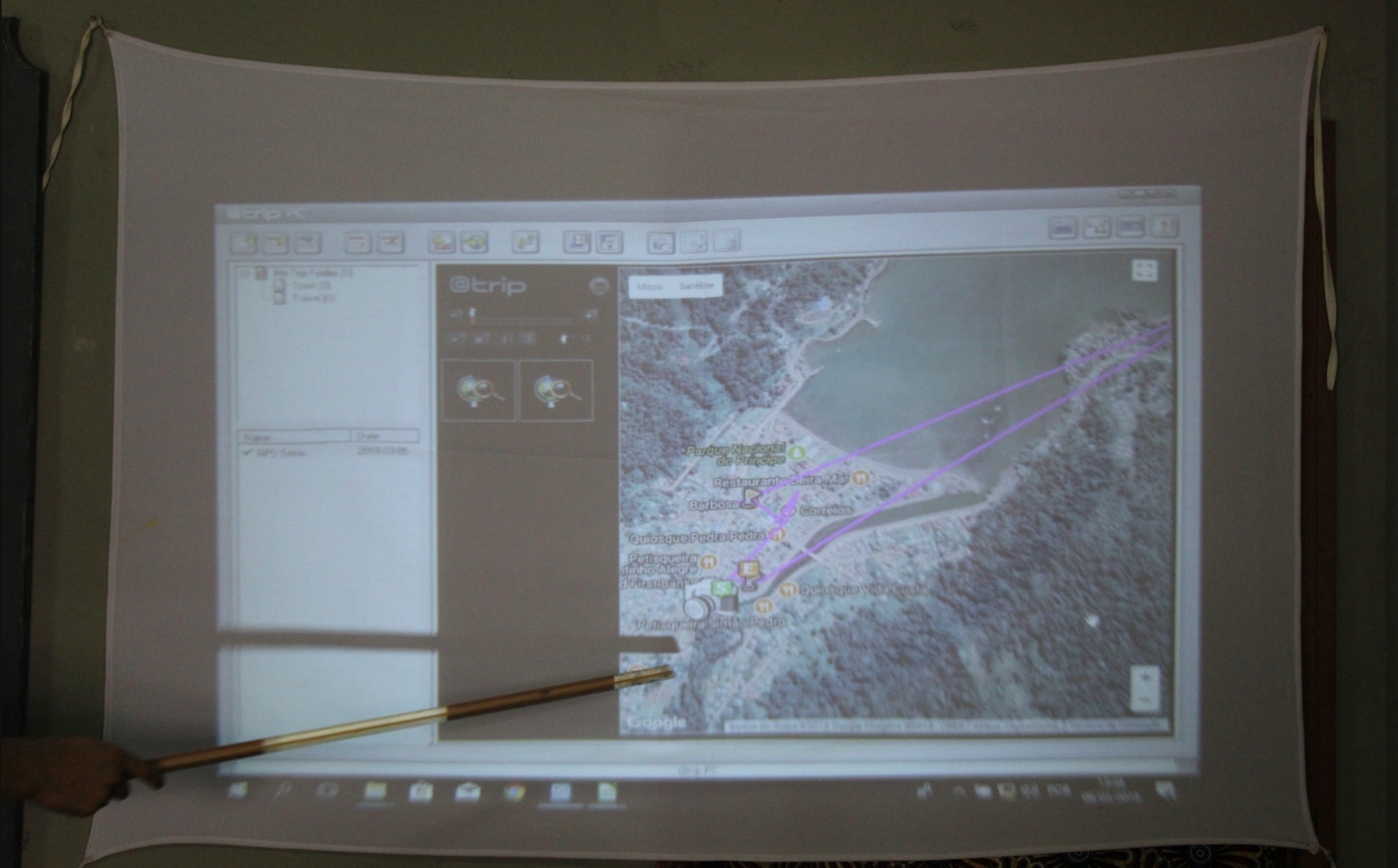
Dog GPS tracking analysis / Image credit: Francis Gouveia
Through after-school programs in Príncipe (São Tomé and Príncipe), Maio (Cape Verde), and Laikipia (Kenya), children aged 10-12 learn basics in IT, programming, and engineering, then apply those skills and concepts to explore the workings of locally-relevant conservation technologies.
Our students use GPS concepts, programming skills, 3D printers, 3D scanners, and micro-computers to understand various conservation devices. We collaborate with local NGOs to develop each Club’s curriculum, ensuring they align with local conservation needs such as habitat loss, biodiversity awareness, or species protection. Since 2017, over 750 students have participated, with measurable outcomes in digital literacy and environmental knowledge, and more than half completing the 3-year program. The Club fosters community-driven conservation, with a globally-replicable model.
Category 3: Species Conservation
- The Species Conservation category highlights how tech solutions power actions to protect, recover, and restore threatened species worldwide.
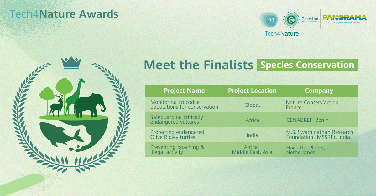
Solution name: Using drones for non-invasive monitoring and assessment of crocodilian populations - a generalizable and accessible tool for stakeholders in conservation
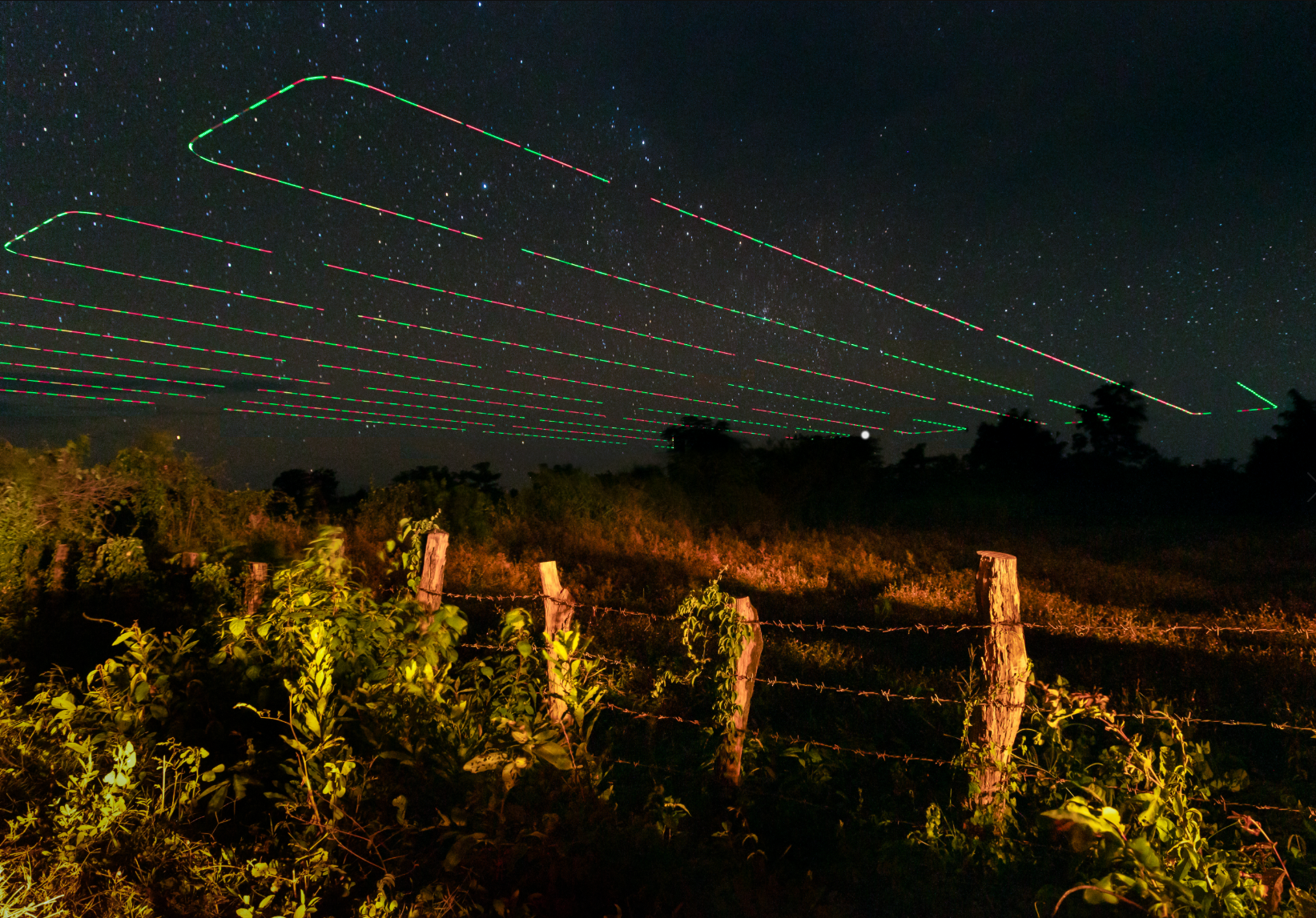
Data acquisition by automatic drone flight / Image credit: Michiel van Noppen
Drones equipped with high-resolution cameras capture images of even partially submerged crocodiles, allowing precise, non-invasive length estimates based on head-to-body allometric ratios. This method overcomes challenges like logistical constraints, cost, need for highly trained personnel, observer bias, detectability, wildlife disturbance, and safety risks with traditional surveys.
By covering remote areas efficiently, the solution enhances biodiversity monitoring, informs conservation strategies, and enables a wide range of additional information to be collected. This solution is very affordable, requiring minimal training. It is accessible to a wide range of users, including indigenous peoples, local communities, and conservation practitioners.
2. Safeguarding critically endangered vultures, CENAGREF
Project name: Computer vision for vulture species monitoring across Africa
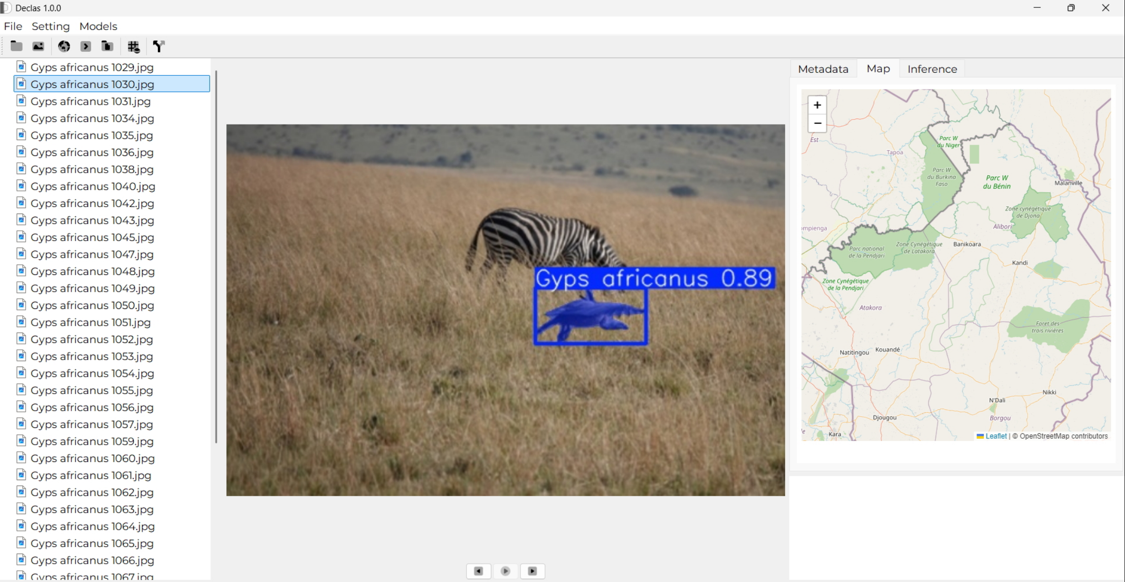
White-backed Vulture detection with Declas / Image credit: Stanislas Mahussi Gandaho
This AI-powered solution supports Global Biodiversity Framework (GBF) Targets 17 and 20 by leveraging biotechnology to strengthen species monitoring and fostering technology transfer for biodiversity conservation.
Using a deep learning model, "You Only Look Once version 11" (YOLOv11), it automates the identification and analysis of critically endangered vultures (Gyps africanus, Gyps coprotheres, Gyps rueppelli, Torgos tracheliotos) in drone and camera trap data. Data from African Parks Network (APN), Southern African Wildlife College (SAWC), Endangered Wildlife Trust (EWT), platforms like iNaturalist, and GBIF will serve to train and validate the model.
The project tackles challenges like labor-intensive monitoring and data gaps. Its open-source design promotes accessibility, collaboration, and capacity-building across African conservation networks, directly addressing gaps in biodiversity data and monitoring systems.
3. Providing connectivity for connected areas, Connected Conservation Foundation
Comprehensive LoRaWAN coverage / Image credit: Connected Conservation Foundation
Protected areas are vital for biodiversity, livelihoods, and climate stability—yet 60% of African parks remain “paper parks” due to limited infrastructure.
Connected Conservation Foundation (CCF) is bridging this gap with Internet of Things (IoT) tools that deliver real-time data to monitor ecosystem health, detect threats early and empower communities.
Since its 2019 pilot at Kenya’s Lewa Wildlife Conservancy, CCF has developed a large-scale sensor ecosystem with partners. Long Range Wide Area Network (LoRaWAN) networks now cover 10M hectares across Kenya, South Africa and Uganda—including the Masai Mara, Tsavo and Northern Rangelands. Over 1,000 sensors and 131 gateways in 35 conservancies feed into EarthRanger, providing a comprehensive 360-degree view of ecosystem health and threats, supporting teams to track assets, onboard sensors, and respond to dangers. This scalable tech stack drives biodiversity conservation action, protects livelihoods and supports the global 30x30 conservation goal.
4. Protecting critically endangereged Olive Ridley turtles, M.S. Swaminathan Research Foundation (MSSRF)
Project name: Protecting endangered Olive Ridley turtles and guiding fishers along Odisha Coast, India, through mobile technology
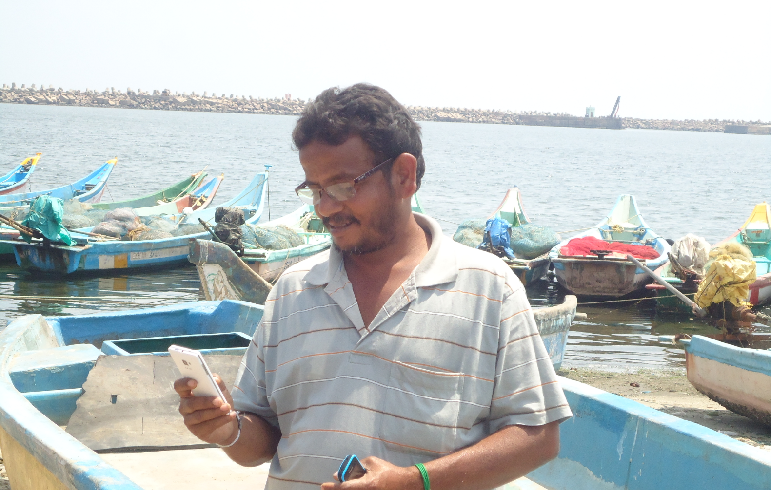
The Fisher Friend Mobile App / Image credit: MSSRF
Recently, FFMA introduced a No Fishing Zone alert to protect endangered Olive Ridley Turtles along Odisha’s coast. Using geo-fencing, it marks critical turtle habitats—including the Gahirmatha Sanctuary and key river mouths—and triggers audio message and vibrating when fishers approach within 200 meters, even without Internet.
This offline feature helps fishers avoid fines and supports turtle conservation by preventing unintended fishing in restricted zones. Since its launch, the No Fishing Zone alert has prevented over 6,866 intrusions, aligning conservation with sustainable fishing and supporting fisher livelihoods and safety. FFMA’s technology ensures that fishers benefit from safer, eco-friendly practices while contributing to the preservation of biodiversity in India’s coastal zones
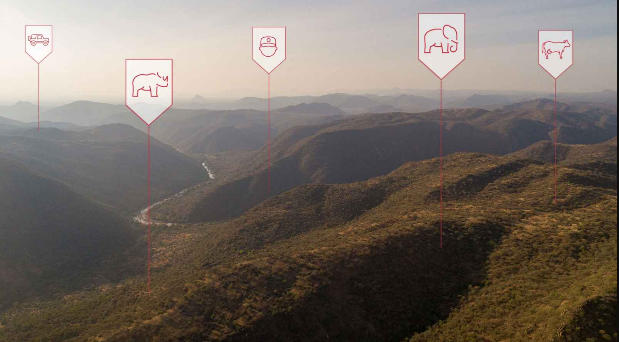
5. Preventing poaching & illegal activity, Hack the Planet
Project name: Scanner Edge - Version 2
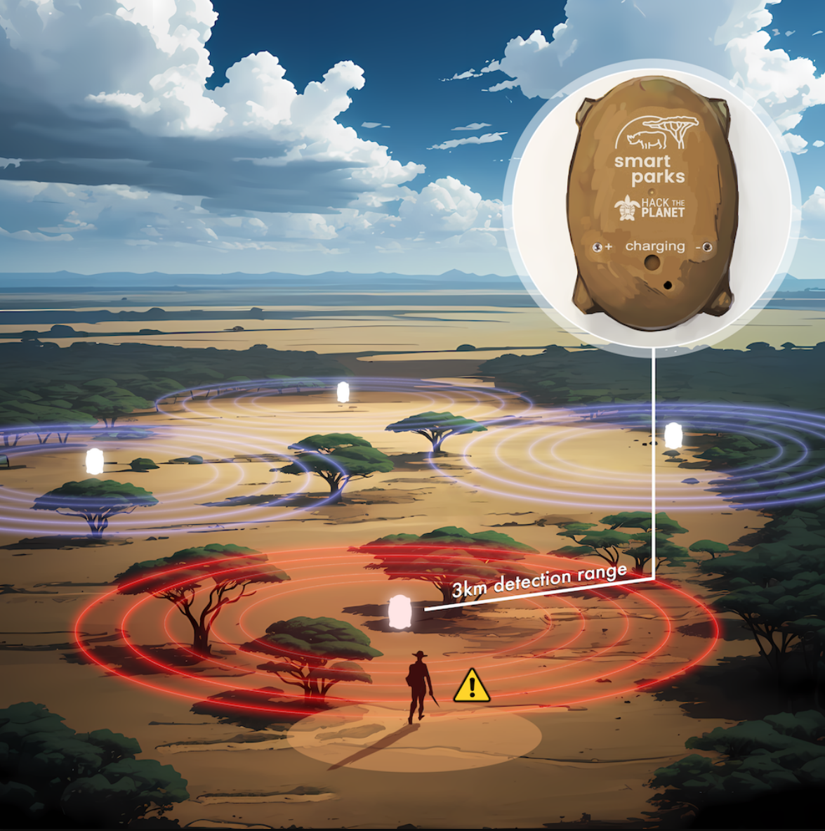
Scanner Edge Setup / Image credit: Hack the Planet
Mobile phones play a central role in poaching operations, for example, for communication between poaching teams and extraction of illegal goods like rhino horns/elephant tusks.
ScannerEdge detects signals from mobile phones, satellite phones, and other RF communication devices, providing conservation authorities with real-time data to identify potential threats. This makes it an ideal tool for uncovering illegal human activity in remote areas.
ScannerEdge is the world's first field-deployable radio frequency scanner with LoRaWAN/satellite and Bluetooth connectivity. Within five years, this technology could be rolled out globally in more than 50 African and Asian national parks. ScannerEdge is actively contributing to protecting endangered animals, thus to the long-term health of our global ecosystem
Disclaimer: Any views and/or opinions expressed in this post by individual authors or contributors are their personal views and/or opinions and do not necessarily reflect the views and/or opinions of Huawei Technologies.
Leave a Comment